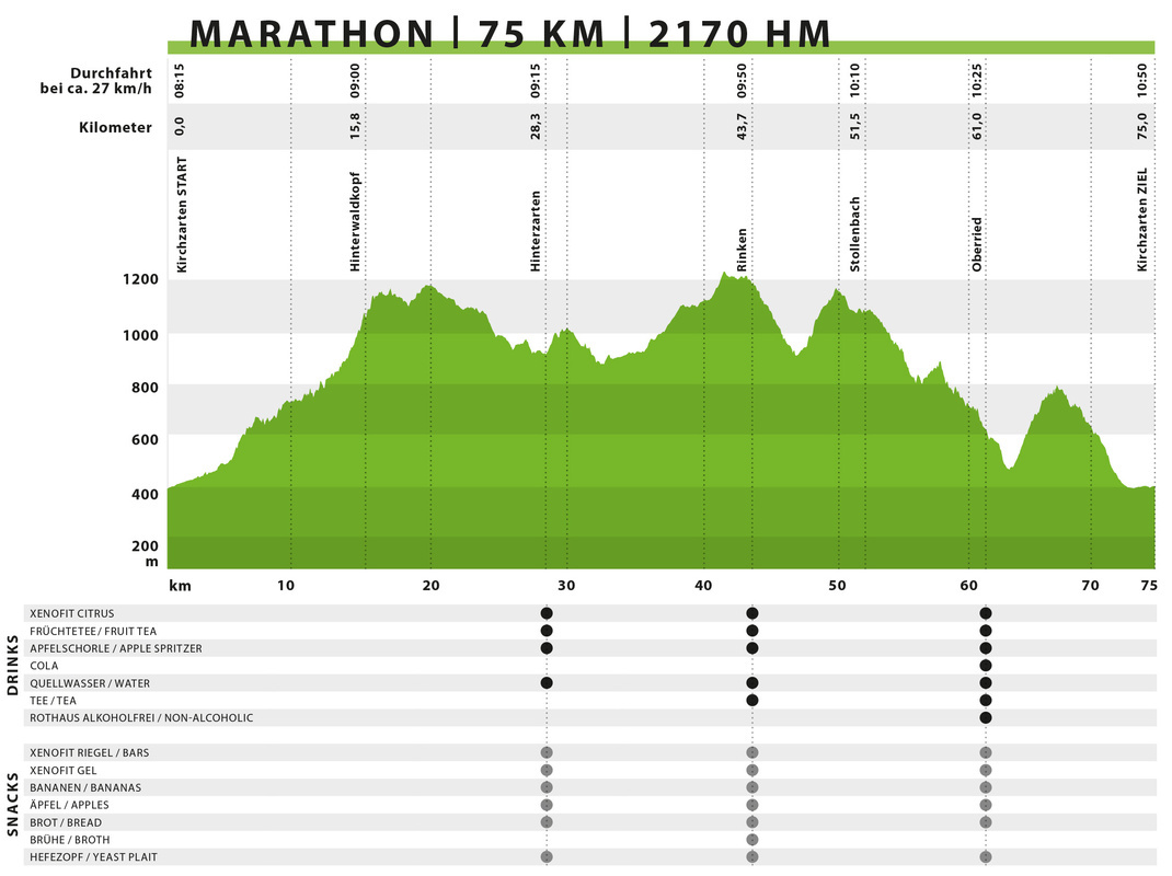
MARATHON | 75 km | 2.170 elevation meters
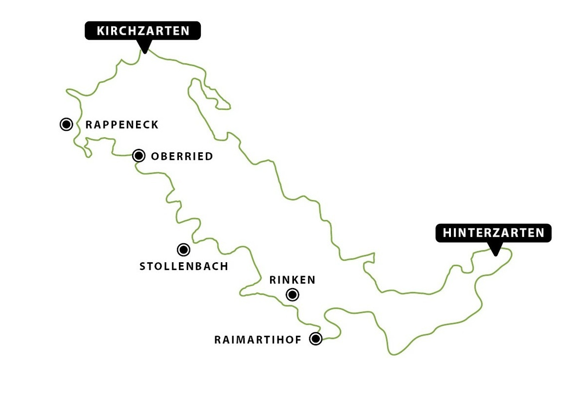
The starting shot for our classic event is in the pedestrian zone in Kirchzarten. Amidst the applause of numerous spectators, all those with sporting ambitions ride out of Kirchzarten, traversing forest paths and trails to Hinterwaldkopfsattel. There, you can briefly enjoy the wonderful view of the Dreisamtal valley before continuing via many smaller, beautiful forest paths to Hinterzarten's Adlerschanze.
By Adlerschanze, you've already covered more than a third of the distance and can replenish your energy at the refreshment point. It's needed here because afterward, there's a steep ascent out of Hinterzarten, over Bruderhalde, on many beautiful, diverse paths to Raimartihof. At Raimartihof, the route diverges for ULTRA, MARATHON, and Short Track. After the challenging climb to Rinken, you've completed not quite two-thirds of your daily stage. Here, at the refreshment point, you can replenish your reserves.
After a short break, you descend towards Zastlertal and then to Berggasthaus Stollenbacher Hütte. Circling around Ruheberg, you head downwards and then onto the Hans-Joschy-Trail. Once you've conquered it, you can briefly enjoy the view of Dreisamtal on Panoramaweg before turning right onto a trail down to Oberried. At the new hotspot in Oberried Obertal, some spectators and Florian Wenig await you, traditionally dressed in lederhosen with lively music!
You can then tackle the approximately 2.5 km ascent to Hennenbach, where you reconnect with the route of ULTRA and Speed Track. Via Dietenbach and the campground in Kirchzarten, you eventually reach the finish line in the stadium.
Elevation profile
Hot spots
# Hinterwaldkopf
# Hinterzarten
# Raimartihof
# Rinken
# Oberried Obertal
# Hinterzarten
# Raimartihof
# Rinken
# Oberried Obertal
Refreshment points
| Verpflegungsstelle | UTM-Koordinaten (WGS84) | Dezimalgrad (WGS84) |
| Hinterzarten | 32T 433487 5305594 | 47.900229°, 8.110067° |
| Rinken | 32T 427032 5303956 | 47.884788°, 8.023983° |
| Oberried | 32T 421140 5309300 | 47.93217°, 7.94421° |


